I can’t help myself – when I’m riding my bike on a back road or through the woods and there is a “No Trespassing” sign I am compelled to find out what is behind it. It makes my wife Lisa nuts. She imagines us being chased away by a toothless lunatic with a shotgun. It could happen, but not yet and I’ll keep trying. Sometimes when I am exploring I will look at my route on Google Maps and check out the satellite photos. You never know what you will find. I found this after a ride on Cape Cod and had to go back to find out what it was.
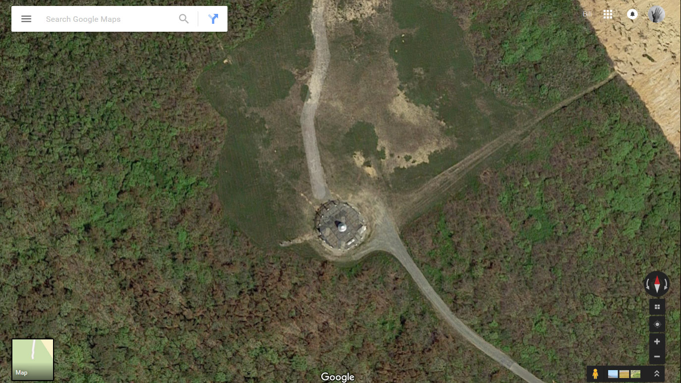 It is always a great excuse for a ride – to check it out, to answer the mystery, to see what is behind that sign, that gate, the fence. In this case there was a chain across the road, but no keep out signs, no fence, the gravel road even changed to good asphalt as I got closer.
Perched on the bluff 100 feet above the Atlantic beach of Cape Cod in North Truro this turned out to be a FAA installation called a VORTAC or Very High Frequency Omnidirectional Range, (VOR) and is a part of the whole navigational system around the world. It was very high tech in the 60’s. It sends out discreet signals from the station along radials from the cent of the station, an aircraft can tune it in, and determine which radial it is on, navigate to or from the station, or by using triangulation with another station, determine it’s point in space. There are highways in the sky, called Victor airways, criss-cross between VOR stations all over and make up the whole system of air traffic control. Even though GPS allows for free flight with very high accuracy, VORS are still a lynchpin of aerial navigation. And if anything ever affected the satellites that make up the GPS system, VOR navigation would be the main backup. (thanks to Bret Wills for this explanation.)
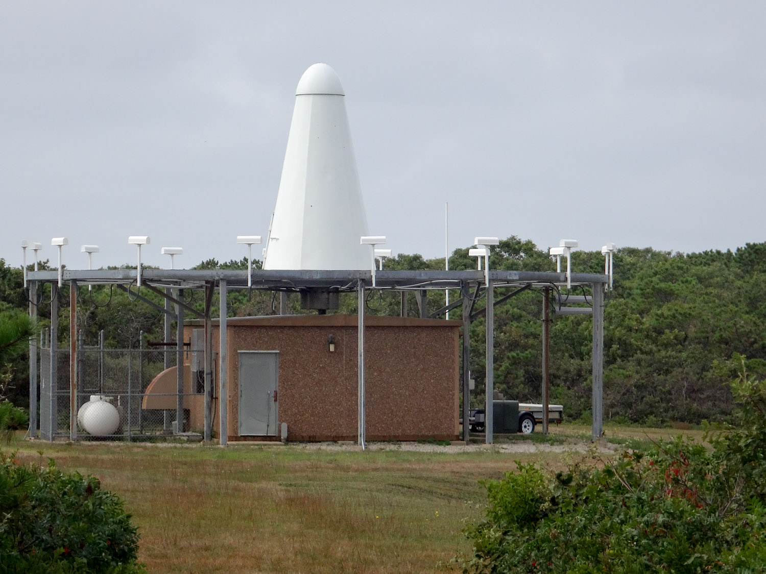
The North Truro VORTAC station
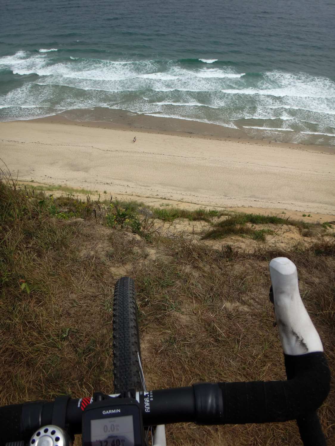
The view from the VORTAC station – about 100 feet above the beach – there are two people walking on the beach in this photo!
North Truro was the site of a US Air Force station (no runways) as part of the DEW line which used radar for “Distant Early Warning” of am incoming Cold War Soviet missile. Today the site is used for a theater, an anagama wood fired kiln for the Truro Center for the Arts, and several other research, recreational and arts organizations. It is now part of the Cape Cod National Seashore Park called the “Highlands Center” and the radar dome is still there, perhaps still operational. The barracks, housing, offices and other facilities are in varying states of decay. Riding around the Highlands Center is a great little adventure, too.