In July I had a glorious week of riding with my pals Larry and Chris. We started out in Grand Lake Colorado on the west side of Rocky Mountain National Park. ( There are links in each day’s description to the Garmin Connect website showing the map and detailed data for each ride.)
Thursday July 17 we rode Willow Creek Pass as an easy day to help me get used to the elevation. 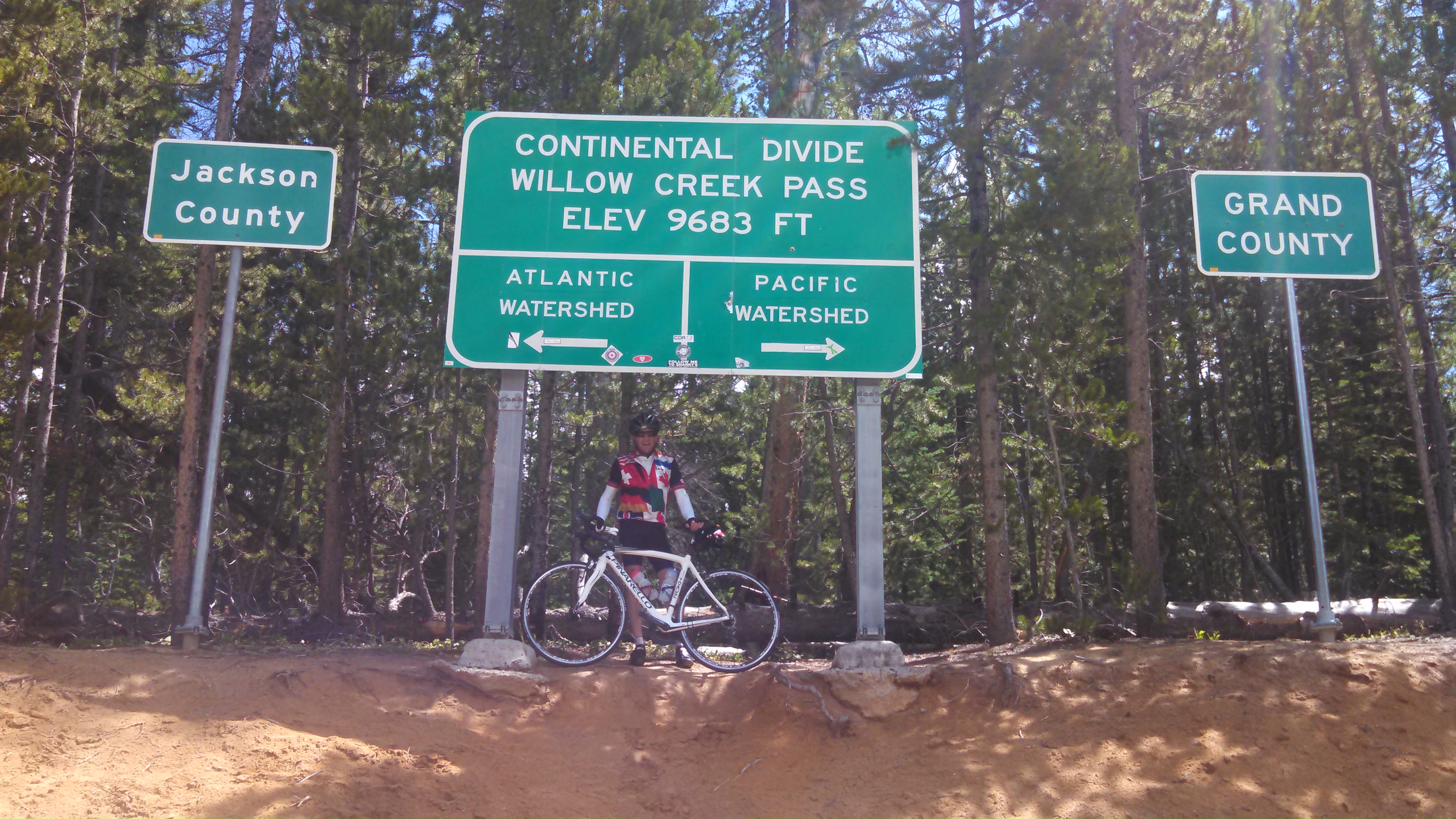 We topped out at 9683 feet after climbing 2556 ft and round trip rode 43 miles. It was a gorgeous day and a wonderful start for the week.
Friday July 18 was a ride from Grand Lake up Trail Ridge Road, but we were turned back by rain after only 20 miles having climbed only 2556 ft – how strange that it was the identical amount of climbing as on the previous day. The top half of the 20 mile descent was in the rain but lower down it cleared up. My hands got pretty cold, but otherwise it was a great ride despite the weather.
Saturday July 19 we had a gorgeous bluebird day to do the ride intended for the previous day: Grand Lake to the Trail Ridge Visitor Center  We rode 55 miles and 4295 feet of climbing (and descending!) The views from the road are spectacular. Traffic on the Grand Lake side was not bad despite being a Saturday in midsummer. Riding in the National Park was quite civilized with great smooth roads and lots of places with outhouses. You do have to pay to get in the Park however.
Saturday afternoon Chris and I drove back over Trail Ridge Road to Boulder and scouted Left Hand Canyon for riding.
Sunday July 20 was an opportunity to ride up Boulder’s legendary Flagstaff Mountain and “Super Flag” because it is closed most of the day during the week to repair damage from last year’s flooding. The short super steep section of Super Flag was too steep for me and I walked it. 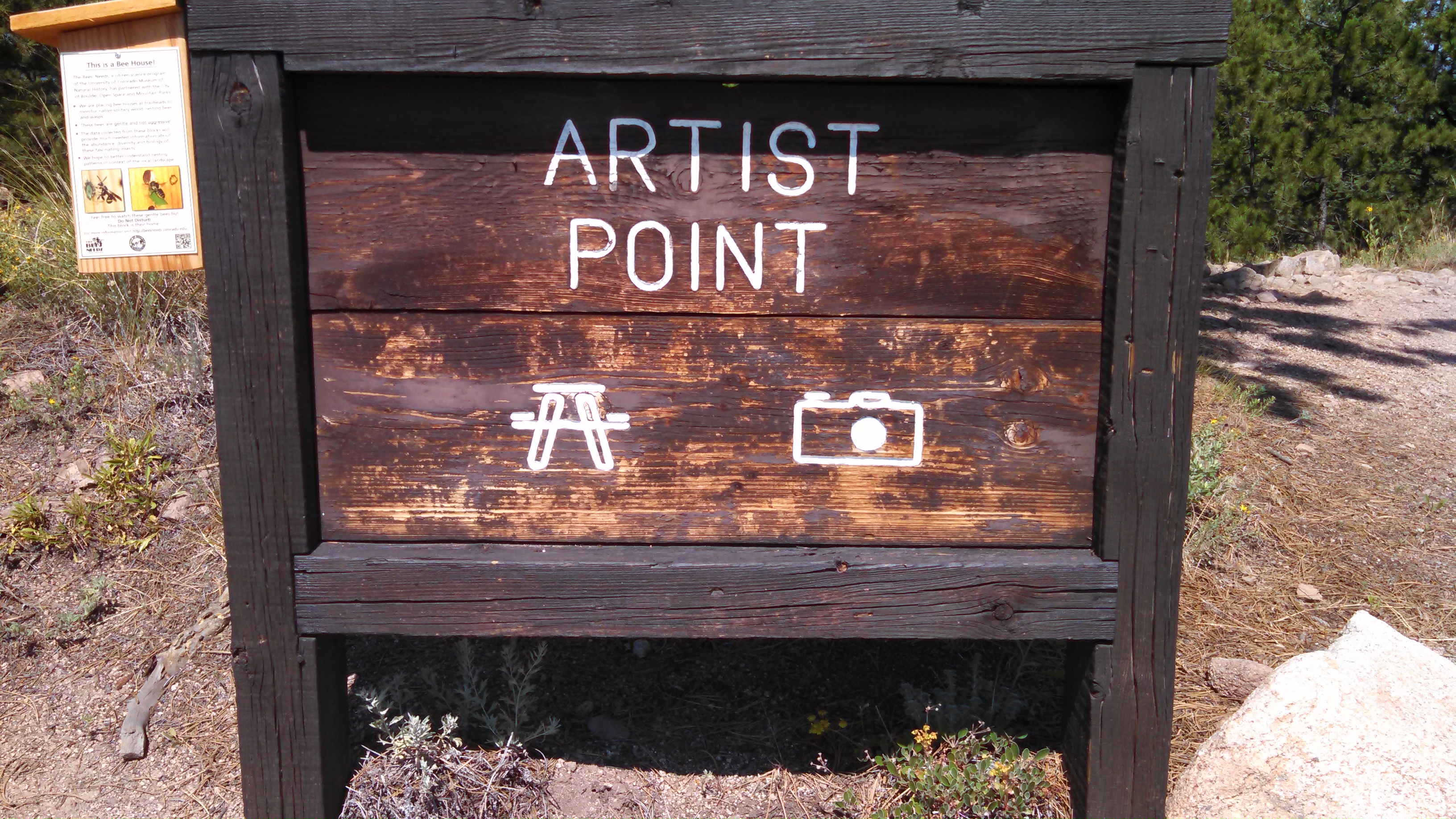 This popular Boulder classic ride was 27.5 miles and 2835 feet of climbing. At the Amphitheater area I took a photo as instructed at Artist Point.
Monday July 21 We chose to take it easy and did a flat day to Lyons and Fruit Loops. With only 1732 feet of climbing over 51 miles it was a nice change from the big hills we had been riding. The flat straight roads of the plains are pretty quiet with decent pavement and good shoulders and moderate traffic.
Fruit Loop Rd. closed by a washed out bridge
The town of Ward is a flashback to the old hippie daze.
You do have to slow down on the descent to cross the unpaved spots. It was great to finally taste the famous spring just below the town of Ward, experience the Utica Street Market and the hippie ambiance of Ward.
And we topped the week off with a ride on Wednesday July 23 from Morrison around the Lariat Loop. By then we were pretty tired. We drove from Boulder to Morrison and mounted up, rode 8 gentle miles up Bear Creek Canyon turned left at Kittredge, over Meyers Gulch, down Parmalee Gulch and then over to Deer Creek Canyon for a tough 10 mile climb. At the top was a cyclist rest stop provided by the local volunteer fire company with a port-o-let and coolers full of gatorade and water, picnic tables in the shade and a place to leave a contribution. How civilized! By then the sky was threatening so we continued on through the aptly named Pleasant Park to Conifer and began a 20 mile descent back to Morrison. After riding about 10 miles into Evergreen the thunder began, lightning and some gentle rain. But on a bike at 20+ mph a gentle rain seems more serious. Still, it went well, the descent was safe and fun and by the time we got to Morrison the rain had let up and we loaded the bikes into the truck and headed back to Boulder, happy and tired. Total: 50 miles and 4642 feet.
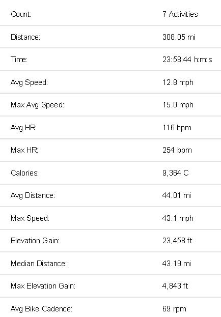
A wonderful vacation over 300 miles and 23,000 feet of climbing. Call me crazy- and here are the final totals: